Category Archives: Where We Live
10,000 Hours and a Mountain
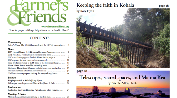
Editor Rory Flynn wrote a really interesting editorial in the June 2015 edition of Farmers and Friends.
He talks about Malcolm Gladwell’s theory (from his book Outliers) that 10,000 hours of practice, plus determination, helps some people develop excellence in their field. He cites concert violinists, the Beatles, Bill Gates, and Hawai‘i’s Kolten Wong.
And then Flynn adds to the equation the importance of place.
He takes us through a really interesting look at what the Hawaiian islands’ geography has meant in the past – to Polynesian explorers, 18th-century British explorers, Americans, Chinese, and others, and what opportunities and livelihoods have been generated here from all those interactions.
And he writes about what advantage geography offers Hawai‘i today, Mauna Kea being one incredible advantage.
“It beckons to a fascinating cohort of 10,000-hour people – accomplished astronomers from around the world. This is where the natural resource of a mountain summit 2-1⁄2 miles high intersects with the excellence of people at the top of their game.”
There’s a lot more. Really good article; I recommend it.
It’s easy to forget all the people and opportunities and livelihoods that were here before. Like the people who came before us, we have amazing resources and we should use them in the smartest way we can.
Guest Post: First Hilo-Hamakua Meeting on Agr & Food Security
I asked Dr. Bruce Mathews, interim dean of the College of Agriculture, Forestry and Natural Resource Management (CAFNRM) at the University of Hawai‘i at Hilo (UHH), to write a guest post about speaking at the first of our community meetings on agriculture and food security.
Dr. Mathews writes:
Mahalo for inviting me to present an overview of Hawaii’s soil resource base for agriculture from the pre-European contact era to the present during the first part of HHCDC Symposia Series on Agriculture and Food Security.
I found that the speakers during the first session provided a solid overview of the current realities facing our local agriculture from all perspectives (resources, new precision technologies, economics, policies, etc.). I appreciated the candid discussions regarding the growth constraints faced by many crop sectors as long as there is strong import competition from continental-based operations (CBOs) and heavy dependence on imported energy and nutrient inputs for our farms.
At the end of my talk I shared a bit about my concerns regarding what I called sustainability madness and ecological imperialism. Many people are very concerned about local use of agricultural chemicals (mainly synthetic biocides such as pesticides, herbicides, etc.) and GMOs, yet the majority in Hawaii consume foods every day that are imported from CBOs where synthetic biocides and (or) GMOs were used in their production.
No doubt there is quite a bit of not in my back yard (NIMBY) ecological imperialism/ecological hypocrisy going on here and this has implications for local society as a whole.
On the other side of the coin, the best genetic manipulations in the world won’t work for long to support economic yields if we cultivate soils depleted of nutrients, organic matter, and beneficial microbial and faunal balance. The problems of climate change such as drought will only be magnified in such soils.
Yesterday I met with a group of current and former UH Hilo College of Agriculture, Forestry, and Natural Resource Management (CAFNRM) students who had leased some land with relatively good soil to farm but recently gave up the lease after raising several different truck crops. Some of the dilemmas that they mentioned facing were the lack of viable organic options to control certain pests, time and labor needed to control weeds when herbicides were not used, security challenges, etc. Obviously, they could not sell much of what did not grow well without effective pest and weed control. There is some zealous Garden of Eden like idealism that permeates the thinking of many until they have faced the reality of actually trying to farm in Hawai‘i.
I hope that my talk also brought to light that with increasing population and cropping intensification Native Hawaiians in the pre-European contact era indeed faced challenges and threats to sustainability despite far fewer constraints posed by invasive species.
Finally, I trust human ingenuity and integrated approaches to solve the challenges we currently face. In contrast to the polarized, advocacy-based discussions seen at some recent agricultural meetings, the dialogue at the first session of this symposia was surprisingly well-received, cordial, deep, and meaningful.
The challenges that agriculture faces in Hawaii demand an open and understanding approach based on the best scientific and verifiable on-farm evidence available so that we can best self-correct as a society for a more sustainable future.
I look forward to attending the 2nd and 3rd sessions of the symposia series.
The three-part symposium is being hosted by the Hilo Hamakua Community Development Corporation, and, as Dr. Mathews mentioned, the first one went well.
The next two meetings are November 5th and November 13th; both are from 6-8 p.m., in the Laupahoehoe Community Public Charter School Bandroom.
The meetings are open to the public; please come if you’re interested. Read more here.
You’re Invited to a Community Meeting re: Hamakua Agriculture
Richard Ha writes:
Save the dates:
- Wednesday, October 29
- Wednesday, November 5
- Thursday, November 13
- 6-8 p.m.
- Laupahoehoe Community Public Charter School Bandroom
On these dates, the Hilo Hamakua Community Development Corporation will hold a series of community meetings to discuss agriculture on the Hamakua Coast. All are welcome (and refreshments are free).
We will take a 40,000 foot view of ag and its outside influences, and then look at the resources available to help us, such as the Daniel K. Inouye-Pacific Basin Ag Research Center (PBARC), the College of Tropical Ag and Human Resources (CTAHR), and the College of Ag, Forestry and Natural Resources Management (CAFNRM) at UH Hilo.
There are many scientists researching various subjects. What do we want them to work on?
Farmers will be at the meeting to share their knowledge and experience.
Are you looking for land to farm? Kamehameha Schools/Bishop Estate with be there, and the Hamakua Ag Co-op has vacant land.
John Cross, former land manager for C. Brewer/Hilo Coast Processing, will attend. Did you know why all the sugar cane equipment had tracks, rather than rubber tires? Did you know that the plantations frequently planted banyan trees as significant landmarks?
Jeff Melrose will be at the meetings. He recently did a study that's a snapshot of agriculture on the Big Island. He will talk about on what is grown on the Hamakua coast and why.
Come and talk story with the presenters, learn where you can get additional information, and speak up on what you would like to know more about in the future.

Inside A Lava Tube
Richard Ha writes:
Back in the ‘80s, there was a fire in Maku‘u between Hawaiian Paradise Park and Hawaiian Beaches. It burned all the way down to the ocean.
I used to do a lot of dirt bike riding back then with my brother-in-law Dennis Vierra and Wayne Blyth. When the fire was out, they made some roads around the perimeter, and any excuse to ride the bikes, right? We went exploring.
We went in by an old hunter’s trail that started near the Maku’u farmers market, and we saw something really strange. There were all these really tall trees that weren’t burned. They were green, and really tall. They were growing through a hole in the lava, and it turned out it was the entrance to a lava tube—the top had collapsed and the trees had grown on top of it. It collapsed a long time ago, because those trees were huge.
We went to explore and we found an entrance into that lava tube that was set up with rocks and nice stone work. Somebody had gone to a lot of trouble to fix it really nicely so you could walk into it, but not too many people at once. Maybe so people couldn’t attack it. Or in case someone was guarding the entrance?We thought it was neat and decided to go back again the next week when we would bring flashlights.
So we went back a week later with our mountain bikes and brought gloves and flashlights and we went into the cave, and it was pretty interesting. The first thing we saw were enormous ‘opihi shells. I’ve never in my life seen ‘opihi shells that size come out of the ocean there in Puna. They were bigger around than a coffee cup. Maybe half again bigger. There were quite a lot of them. And we saw charcoal, so it looked like people had made fires there.
We started walking. The cave was maybe ten or fifteen feet high in places. The top had collapsed over time and there was a pile of rubble maybe three or four feet high in the middle, so you had to walk on either side of it.
It wasn’t perfectly round, but it got narrow on the left and right edges and looked like there were shelves, like you could set things there, or maybe hide bodies there, but none of us said that out loud. And we didn’t dare go look.
We kept walking, maybe about a mile and then we came to what looked like a dry waterfall. The shape of the lava went uphill and we could feel fresh air at the top, so we climbed up and kept going.
Toward the end, we found more rock work. At that end, only one person at a time could pass through the narrow opening someone had created rocks. It led to an opening at the top so we could leave the lava tube, and we came out in the forest.
We had absolutely no idea where we were. No idea at all. It was still light out but we had no way to find civilization.
It was pitch dark in the lava tube, but we knew that was the only way we could find our way back, so we went back in. We went back the way we’d come and we started going faster and faster, because it was kind of spooky in there.
About halfway through we realized we could see some diffused light coming from the ceiling. There was a hole in the ceiling where the lava was very thin.
And what occurred to me was that if anyone was walking in the forest above and fell through into the lava tube, they would have absolutely no way of finding their way out. Without a flashlight, it’s pitch dark and you absolutely wouldn’t be able to find your way out at all. That would just be it. It was a scary thought.
I don’t know if it’s a place where people used to hide. Or was it a burial cave? How many hundreds of years ago was that? I couldn’t see any evidence of people having lived in that area – no taro lo‘i or anything. There were no trails there. Who built that stone work? Who did all that work? It was very organized. Was it to protect themselves? Did they have people out there at the entrances?
We only went into it that one time, and it’s still out there somewhere, between Pahoa and Ainaloa on the transfer station side of the highway, and I’m sure there are many others, too. I hadn’t thought about that in many years, but now with all the lava moving through the area and going down into cracks and everything, it came to mind. It was an interesting experience.
From Big Island Video News:
PUNA, Hawaii – Lava is a mere three tenths of a mile from entering Kaohe Homesteads, reports Hawaii County Civil Defense. An evacuation has not yet been ordered for residents of Kaohe but that could change at any time. Civil Defense personnel will be conducting door to door surveys and notification in the subdivision starting today.
Around The World on a Wa’a
Richard Ha writes:
The Polynesian voyaging canoes Hokule‘a and Hikianalia departed Hilo a couple days ago, headed for Tahiti on the first leg of an around-the-world voyage. Kalepa Babayan is captain of the Hokule‘a, and he melds ancient ways with modern technology and education. He is one of the most solidly grounded person I know.
Hokule‘a crew member Na‘alehu Anthony blogged about leaving Hilo in It Takes a Community to Launch a Canoe:
Literally thousands of members of our ʻohana waʻa (canoe family) have come to see the canoes. School groups by the busloads have come to share mele (songs) and hoʻokupu (offerings) to the canoes and crew. But if one looks a little closer, they can start to really notice how well this community still understands the sense of aloha. Every day for the past 10 days this community has come out to feed the crew three meals a day. Cars have been dropped off to help with last minute runs to the store. People have come without any expectation of personal gain to give of their time to just help us prepare for this 47,000 mile journey. Just this morning after sunrise, one of the uncles from nearby came to drop off a dozen or so lei, that he personally strung together with flowers from his yard, just to “Aloha” the canoes. He didn’t even ask to come aboard, rather, he left them in the care of one of our watch captains to bless the canoes with the sweet fragrance that reminds us all of Hilo.
We did our small part by supplying bananas and tomatoes, and feel very privileged to be able to support Hawai‘i's voyagers, along with hundreds of others. We learned, early on, that the voyaging crews like fresh fruit, especially longer into the trip, so we do this as much as we can on the voyages out of Hilo. We do our best to stage the ripening at different times, and try to see how far into the voyage we can get the bananas to last. We once got a batch to last until the crew reached the equator.
Keaukaha was the host community for the wa‘a and their crews, and its president, Patrick Kahawaiola'a, was in charge of coordinating. June and I went to Palekai to see the canoes the other day.
As we walked down to the water, we ran into Bruce Blankenfeld, the captain of Hikianalia. I knew he had lots on his mind, so I introduced myself by saying we had supplied bananas on previous trips, and that they should "try keep the bananas separated so they no all go off at one time." He knew exactly what I meant. I gave him the thumbs up and we kept on going.
To me, the voyage of the Hokule‘a and the Hikianalia represents hope for mankind. It is about the spirit of aloha. It is about using the resources available, modern and ancient, in a smart way. But mostly it's about attitude. There are a thousand reasons why no can. We need just one reason why, CAN.
From www.hokulea.com:
Island Wisdom, Ocean Connections, Global Lessons
Hōkūle‘a and Hikianalia, our Polynesian voyaging canoes, are sailing across Earth’s oceans to join and grow the global movement toward a more sustainable world. Covering 47,000 nautical miles, 85 ports, and 26 countries, the Mālama Honua Worldwide Voyage will highlight diverse cultural and natural treasures and the importance of working together to protect them. The Mālama Honua Worldwide Voyage began in 2013 with a Mālama Hawaiʻi sail around our archipelago, and will continue through 2017 when our new generation of navigators take the helm and guide Hōkūle‘a and Hikianalia back to Polynesia after circumnavigating the globe.
The Hawaiian name for this voyage, Mālama Honua, means “to care for our Earth.” Living on an island chain teaches us that our natural world is a gift with limits and that we must carefully steward this gift if we are to survive together. As we work to protect cultural and environmental resources for our children’s future, our Pacific voyaging traditions teach us to venture beyond the horizon to connect and learn with others. The Worldwide Voyage is a means by which we now engage all of Island Earth—practicing how to live sustainably, while sharing, learning, creating global relationships, and discovering the wonders of this precious place we all call home.
A Big Picture Look
Richard Ha writes:
Yesterday I sat in Judge Nakamura’s courtroom full of people both for and against the Thirty Meter Telescope (TMT) being built on Mauna Kea. I looked over at Kealoha Pisciotta, who has led the opposition all these years, and thought about how much I admire her.
As I sat there, I thought back to 2008, when rising oil prices started being such a big concern. At the top of my mind then was finding an economic alternative to tourism and opportunities for keiki education, both of which the TMT will provide. Locating the TMT here is a great opportunity, and I put a lot of effort into supporting it.
As I sat there yesterday, I thought, too, about how the TMT will help the Big Island cope with our rising energy costs and changing economy; because of it, money will flow into our economy instead of out. It will bring 10 years of construction jobs, and $1 million/year toward Big Island student education for each of more than 55 years. More importantly, it will bring to the Big Island an attitude of “Not, No Can. CAN!”
In 2007, I’d met Gail Tverberg at my first Peak Oil conference in Houston. A former insurance actuary whose job was to price insurance risk, she is someone who approaches the world oil supply problem from a risk management perspective. I helped bring her to the Big Island to give presentations, and she observed that our dependence on tourism makes Hawai‘i very vulnerable.
In 2008, shale and gas production hadn’t yet started in earnest. Natural gas prices were very high at $12/thousand cubic feet. According to a USDA analysis, there was an 80 percent correlation of natural gas price to ammonia fertilizer cost, and that had a frightening effect on local farmers. The price of natural gas dropped to $2/mcf, and now it’s around $4.50/mcf. This, coupled with a subsequent increase in natural gas supply, has given us some breathing room. But it’s only temporary.
We have another fairly unique opportunity to protect ourselves against seriously rising energy costs, which are already impacting our lives negatively and will continue to go up if we don’t make changes:
Geothermal energy.
After having attended five Association for the Study conferences (the only person from our state to do so) I’ve found that it’s all a matter of 1) cost, 2) what works and 3) comparative risk.
Geothermal addresses all three of those points. It’s inexpensive compared to using oil to produce our energy; we already know that it works; and after decades of experience with it here, the comparative risk is low.
It also allows the possibility of making hydrogen, which we can use to fuel our ground transportation, and also ammonia fertilizer for farmers. There are a lot of wins there.
Energy On The Farm
Richard Ha writes:
We’ve had two days of rain and Wai‘a‘ama Stream is a raging torrent. Incredible amounts of water running down the flume!
In addition to using the water that’s all around us, we utilize the energy of the sun. Because what drives plant growth? Sun energy in a certain range.
Photosynthetically active radiation
From Wikipedia, the free
encyclopedia
Photosynthetically active radiation, often abbreviated PAR, designates the spectral range (wave band) of solar radiation from 400 to 700 nanometers that photosynthetic organisms are able to use in the process of photosynthesis….
We use a sensor that measures the sun energy per meter squared and gives a number for the total accumulated in a day. We keep track of the total.
The sun energy total was low these last two days. This is something we expected, because the river has been raging.
Farmers routinely use scientific information. This is why I say farmers have common sense.
Time Travel: Looking Back At Our Land
Richard Ha writes:
We’re planning to landscape the area around our new hydroelectric system with canoe plants, the plants that the first Polynesian settlers brought with them from their previous island homes to help them survive and thrive in their new land.
They were the original organic farmers. They had no oil back
then, of course, so no oil technologies.
And they did not just survive in their oil-free lives, but thrived and supported a large population here well (research suggests it was a
population as large as we have now).
So as we reach the age of Peak Oil, the end of easy and cheap oil and all that came with that, I want to explore how they did it. I
want to learn from them and see what, from those times, we can focus on again to improve our lives now. Our hydroelectric system is another example of what we are doing in these regards.
There are still people, of course, who have always lived
with the old ways, and who continue to do so. I met some people at the Hawai‘i Community College who are perpetuating this culture and who have offered to help me. I’ll write more about that soon.
For now I thought I’d revisit what we know happened on this
land before we started farming it. A lot of this information comes from the Cultural Resources Review of our poperty done by the USDA’s Natural Resources Conservation Service.

Our farm encompasses three ahupua‘a in the district of South Hilo:
1. Ka‘upakuea at the north (bordered at the south by Makea Stream).
We don’t know much about what went on in Ka‘upakuea before the mid-19th century. In the mid-1800s, both Ka‘upakuea and Kahua were government lands, which were lands Kamehameha III gave “to the chiefs and people.” Ka‘upakuea was part of Grant 872. (Read the 1882 document A Brief History of Land Titles in the Hawaiian Kingdom for more on Hawai‘i’s historical land system.)
The area was later part of a sugar plantation, and has unpaved roadways and a west-east flume. Kaupakuea Camp was within the area of what’s presently our farm.
2. Kahua (which is between Makea and Alia Streams).
Kahua is a very narrow ahupua‘a, approximately 600 feet wide. It extends from the coast to about Makea Spring, which is at about the 980 foot elevation.
Kahonu (an ali‘i who was descended from both the I and Mahi
lines of chiefs, and who was in charge of the Fort at Punchbowl ca. 1833-34) was awarded either the whole of Kahua ahupua‘a or just the northern mauka half of it (references differ) as LCA 5663.
When he died in 1851, his relative Abner Paki (father of
Bernice Pauahi and hanai father of Lili‘uokalani) held the lands “under a verbal will from Kahonu” (Barrère 1994:138). When Paki died in 1855, the lands were listed as Bishop Estate lands.
3. Makahanaloa at its southern edge (bordered by Alia and Wai‘a‘ama Streams).
The ahupua‘a of Makahanaloa (Maka-hana-loa) runs from the coast about 3.5 miles up to the 6600-foot elevation. Kapue Stream flows from the base of Pu‘u Kahinahina down through Makahanaloa. Magnetic Hill is at the southwestern corner at the top of the ahupua‘a, which is a little over a mile wide and meets the North Hilo district boundary.
In the Great Mahele of 1848, 7600 acres of Makahanaloa and
Pepe‘ekeo were awarded to William Charles Lunalilo (an ali‘i who later became king, from 1873 until his death in 1874). Upon his death, his personal property went to his father Charles Kana‘ina.
Here are a couple of interesting facts about Makahanaloa
ahupua‘a: Somewhere within this area, though the exact location is unknown, there was (is?) an “ancient leaping place for souls.”
And according to historian Mary Kawena Pūku‘i, a sacred bamboo grove called Hōmaika‘ohe was planted at Makahanaloa by the god Kane. “Bamboo knifes used for circumcision came from this grove,” she wrote.
Sugar cane was one of the canoe plants; it came with the early Polynesians to Hawai‘i and they used it as food and sweetener, and chewed it to strengthen their teeth and gums.
The farm sits on land that was formerly part of a sugar plantation that had its origins in 1857, when Theophilus Metcalf started Metcalf Plantation. After his death in 1874, the 1500-acre plantation was purchased by Mr. Afong and Mr. Achuck and its name changed to Pepeekeo Sugar Company. In 1879, they also acquired the 7600-acre Makahaula Plantation. By 1882, both were combined as Pepeekeo Sugar Mill & Plantation. In 1889, Afong returned to China, leaving the plantation in the hands of his friend Samuel M. Damon.
Over the years, it changed hands several more times. C. Brewer
& Co. bought the plantation in 1904, added a plantation hospital and improved housing. By 1910, plantation fields were connected by good dirt roads and harvested cane was delivered to the mill by railroad cars and stationary flumes.
Post-1923, the plantation improved its soil every year by adding coral sand (from Wai‘anae), bone meal and guano. “The sand was bagged and hauled into the fields by mules to be spread” (Dorrance & Morgan 2000:101). Eucalyptus trees were planted as windbreaks, protecting the fields near the ‘ōhi‘a forests.
Water came from Wai‘a‘ama Stream and Kauku Hill.
Plowing was
done to 18 to 20 inches. After 1932, tractors with caterpillar tracks were used for plowing. From 1941, trucks hauled harvested cane to the mill.
In the early 1950s, lots and houses on the plantation were sold to residents.
Under C. Brewer, there were several mergers: Honomu Sugar Company in 1946; Hakalau Sugar Company in 1963; consolidation of Wainaku, Hakalau, Pepeekeo, and Papaikou sugar companies in 1971, and a final merger in 1973 with Mauna Kea Sugar (once 5 separate plantations: Honomu, Hakalau, Pepeekeo, Onomea and Hilo Sugar Company) to form Mauna Kea Sugar Company, the state’s largest with 18,000 acres of cane (Dorrance & Morgan 2000:104).
Prior to the final merger, Mauna Kea Sugar Company had formed
a non-profit corporation with the United Cane Planters’ Cooperative, the Hilo Coast Processing Company, to harvest and grind sugarcane.
The Hilo Coast Processing Company and the Mauna Kea Sugar
Company (at that point called Mauna Kea Agribusiness Company) mill shut down in 1994.
We started farming on this land in 1994.
I’m very interested in knowing more history about this place. If you or your family know old stories about this area, I would love to hear them.
Room With a View
Richard Ha writes:
This is the view from my “office” window.

I took it from the air-conditioned cab of my bulldozer, where I can even charge my iPhone. I was on a conference call yesterday while I was in the middle of clearing some brush that we are going to replace with something more productive. Not bad, huh?

We’re busy putting our marginal lands into production. While we’re at it, we need to provide safety barriers using dual-use plants and trees. We need to protect the streams by preventing erosion and runoff over the long term. If we can accomplish this with plants that provide food, so much the better.
On the land surrounding the hydro generator, we want to highlight the modern and the ancient. The hydro generator represents the modern, and the plants the Polynesian navigators brought with them in their canoes are of particular interest to me.
Being a banana farmer, I am familiar with the cooking bananas, the mai‘a maoli and the mai‘a popoulu. The mai‘a maoli produced a large, heavy bunch. I remember thinking, I would have put that in the canoe as well. The mai‘a popoulu was probably a backup. It was susceptible to wind and not very strong, relative to competition from grasses, etc.
Anybody have those varieties? I don’t see them aroundanymore. They succumbed to the fusarium wilt, like the Bluefield bananas did in the 50s. That caused the world banana trade to shift to the Cavendish type of banana, which are starting to succumb to another race of the fusarium wilt. That is the biggest threat overhanging the world banana industry today.
More pictures from my bulldozer. That’s bamboo in the distance. It’s less than three years old, and I’m guessing it’s 60-plus feet tall and 5 feet in diameter now. That’s with only two applications of fertilizer.
We have ‘opae in this healthy stream on our farm.
All the rose apple trees on Wai‘a‘ama Stream succumbed to a fungus a short time ago. We are going to plant other trees here, which will keep invasive species down and also help to keep the river cool.
This soil was fallow after a banana crop, and as I was walking along I saw earthworms. Healthy soil.
(I videotaped an earthworm!)
I am fascinated by our Hawaiian ancestors’ ability to survive, well, in a world without draft animals and metals.
I’m planning to write more about all this from a farmer’s point of view.